


New Delhi, March 17
Jammu and Kashmir and Himachal Pradesh received fresh bouts of snowfall on Monday, stranding several vehicles in both states, while the plains were lashed by rains.
Other northern states of Rajasthan, Punjab and Haryana received light rains, leading to a drop in temperatures by a few notches, while in the national capital Delhi, the air quality improved to the “satisfactory” category after Sunday’s rain.
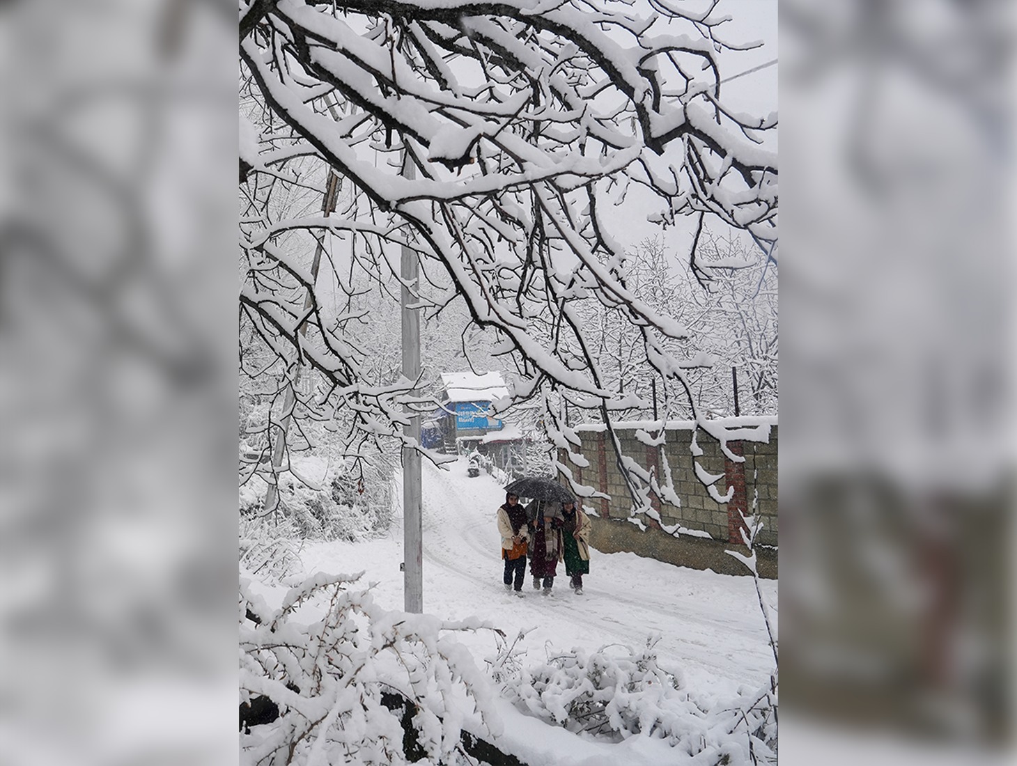
Most higher reaches of Kashmir received moderate to heavy snowfall, while the plains were lashed by rains, disrupting vehicular movement in some stretches, officials said.
Several vehicles got stuck after heavy snowfall along the Sinthan Top, following which police and army carried out a rescue operation on Sunday night to evacuate 214 stranded tourists and locals, they said.
The tourist resorts of Gulmarg in north Kashmir’s Baramulla district, Doodhpathri in central Kashmir’s Budgam district, and Sonamarg in central Kashmir’s Ganderbal district received moderate snowfall.
The higher reaches, including Pir Ki Gali along the Mughal Road in Shopian district of south Kashmir, Zojilla axis, Gurez in north Kashmir’s Bandipora, Sadhna Top in north Kashmir’s Kupwara, and Sinthan Top connecting Anantnag in south Kashmir to Kishtwar in Jammu region, received heavy snowfall.
Sadhna Top has received over 12 inches of fresh snowfall, while Sinthan Top recorded around 6 inches of snow, officials said.
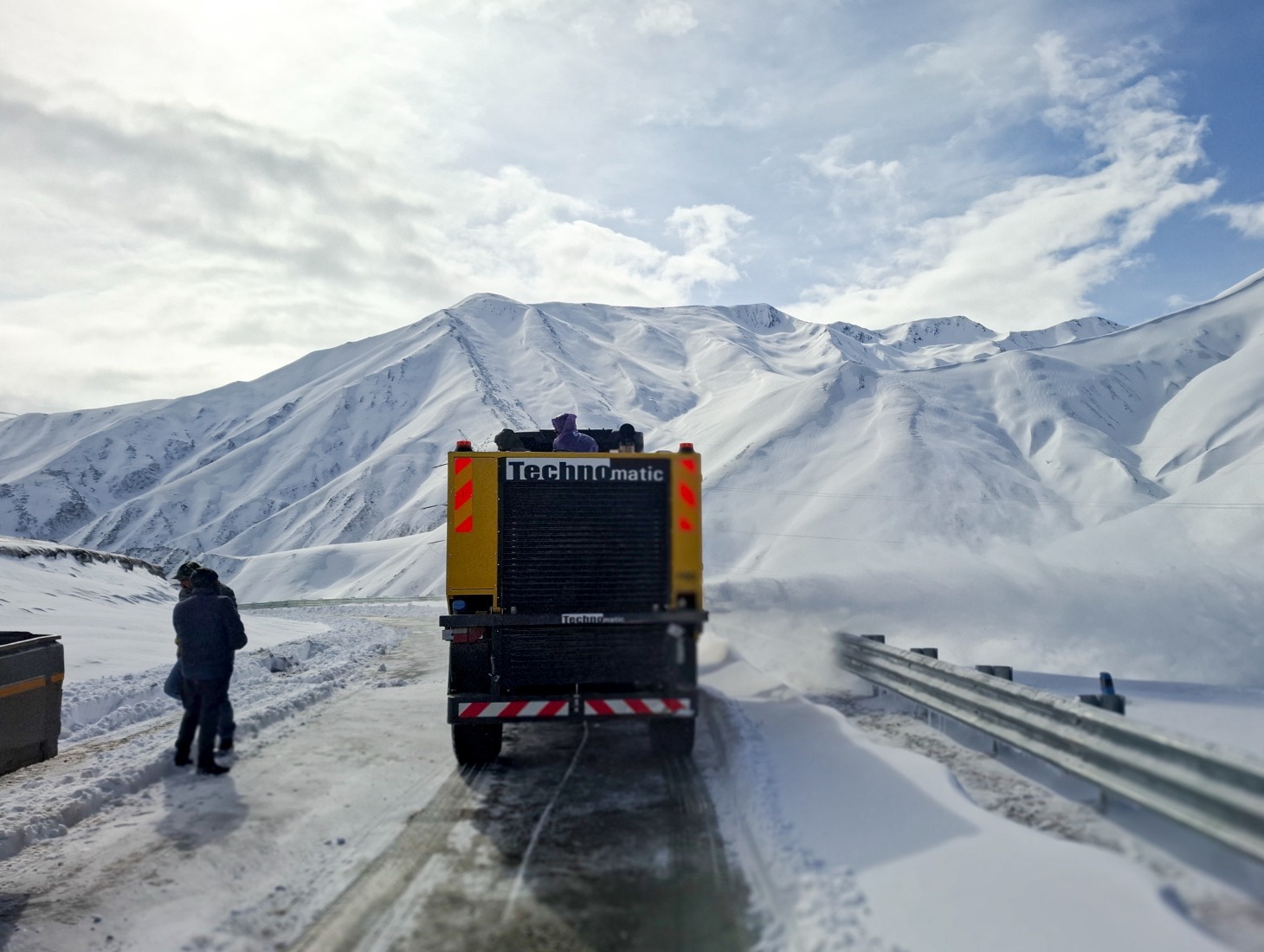
Snowfall has led to the closure of vital road links in the Valley, including the Gurez-Bandipora road, Sinthan-Kishtwar road and the Mughal Road, the alternate road connecting Kashmir Valley to the Jammu region.
Vehicular movement has also been suspended on the Srinagar-Leh highway due to the accumulation of snow at Zojila Pass.
The plains of the Valley, including Srinagar, were lashed by rains which continued intermittently till Monday morning.
Himachal Pradesh too witnessed a fresh spell of snow on Monday, while a severe storm accompanied by lightning and hail lashed the state capital Shimla and surrounding areas.
As snowfall continued in the suburbs of Manali for the second consecutive day, police moved over 1,000 vehicles stranded near the Atal Tunnel in Rohtang since Sunday night to Manali.
Vehicles were stranded at several points due to ice formation on roads, causing hardships to tourists.
Some of them started on foot from the Atal Tunnel down towards Solang Nallah. Many others said they narrowly escaped accidents as their vehicles skidded on the snow.
The Dhauladhar range in Kangra district was covered under a thin blanket of snow on Monday morning, while snow was also witnessed in Dalhousie in Chamba district.
A severe storm accompanied by lightning and hail lashed Shimla and the surrounding areas on Monday, disrupting normal life. Dark convective clouds overcast the sky, giving a night-like appearance to the day, with lights glittering from buildings against an obscure landscape.
Visibility was reduced to zero, and vehicles were forced to move at a snail’s pace with headlights on during midday.
According to Shobit Katariya, an official at the Shimla Met office, the higher reaches of Shimla district received 10.2 cm of snow in the 24 hours until Monday evening, followed by Kalpa (6.4 cm) and Lahaul-Spiti (2 cm).
Traces of snow were also witnessed in Shillaro and Bharnaur, while light to moderate snowfall was reported in isolated high altitude areas of Shimla, Kullu, Mandi, Kangra, Kinnaur, and Lahaul and Spiti districts.
Some parts of Rajasthan witnessed light rain and thunder till Monday morning, leading to a 2-4 degrees Celsius drop in temperatures.
The highest maximum temperature recorded was 38.6 degrees Celsius in Chittorgarh, while the lowest minimum temperature was registered at 11.7 degrees Celsius in Fatehpur.
The India Meteorological Department’s meteorological centre in Jaipur has predicted that a fresh western disturbance would bring thunderstorms and rain at isolated places in the state this week.
Weather conditions are likely to remain mainly dry on March 16 and 17, while another strong western disturbance is likely to become active between March 18 and 21. Under its influence, gusty winds with speeds of 40-50 kilometres per hour and rainfall are likely at isolated places in the state.
On March 18, some areas in Jodhpur and Bikaner divisions may witness thunderstorms accompanied by light rain, while the remaining parts of the state are likely to experience mainly dry weather, it said.
On March 19 and 20, parts of Ajmer, Jaipur, Bharatpur, Kota, Jodhpur and Bikaner divisions are likely to experience strong winds with speeds of 40-50 kilometres per hour and rain, the weather office said.
Light rains lashed some places in Punjab as well, causing a drop in temperatures.
Pathankot and Rupnagar in Punjab received 14 mm and 9.5 mm of rain, respectively. Hoshiarpur and Amritsar also witnessed rainfall activity.
Meanwhile, the national capital Delhi saw an improvement in air quality after Sunday’s rain, with the air quality index settling in the ‘satisfactory’ category.
Many areas of Delhi received rain on Sunday. The 24-hour cumulative rainfall till 8.30 am showed that Safdarjung received 0.4 mm, Lodhi Road 0.5 mm, and Ayanagar 0.8 mm of rainfall, while Palam and Ridge recorded trace rainfall, according to weather observations.
Following the rainfall, Delhi’s air quality also improved to 97.
PTI